Before any excavation project begins, one question matters more than anything else:
What is underground?
From buried electrical lines and fiber optic cables to gas mains and water systems, underground utilities create a hidden infrastructure network that contractors must avoid at all costs. A single mistake can lead to service outages, expensive repairs, safety incidents, and major project delays.
That is why professional utility locating depends on advanced equipment, experienced technicians, and accurate detection methods.
Modern utility locating technology helps crews identify underground infrastructure quickly and safely before digging starts. However, not all locating equipment serves the same purpose. Different underground conditions require different tools, and the best utility locating companies know how to combine technologies for maximum accuracy.
In this guide, we explain the essential equipment used in utility locating, how each tool works, and why advanced locating technology plays a critical role in excavation safety.
Why Utility Locating Equipment Matters
Underground infrastructure becomes more complex every year. Cities continue to expand utility systems while aging infrastructure remains buried beneath roads, commercial properties, and construction sites. As a result, excavation crews face greater risks than ever before.
Without proper utility locating equipment, contractors may accidentally strike:
- Gas pipelines
- Electrical cables
- Communication lines
- Water mains
- Sewer systems
These incidents can cause job site shutdowns, emergency repair costs, worker injuries, environmental damage, utility outages, and heavy regulatory penalties. Professional utility locating equipment helps eliminate these risks by providing accurate underground utility detection before a single shovel hits the dirt.
The more accurate the locate, the safer and more efficient your project becomes.
💡 The 811 Blind Spot: Why You Need Private Locating
Many contractors assume that calling 811 is enough. While 811 is essential and legally required, public locators only mark public utilities up to the meter. Private service lines, structural concrete, and undocumented backyard or parking lot lines remain completely invisible to them. Advanced private locating equipment fills this gap, protecting your crew where public locators cannot go.
Electromagnetic Utility Locators
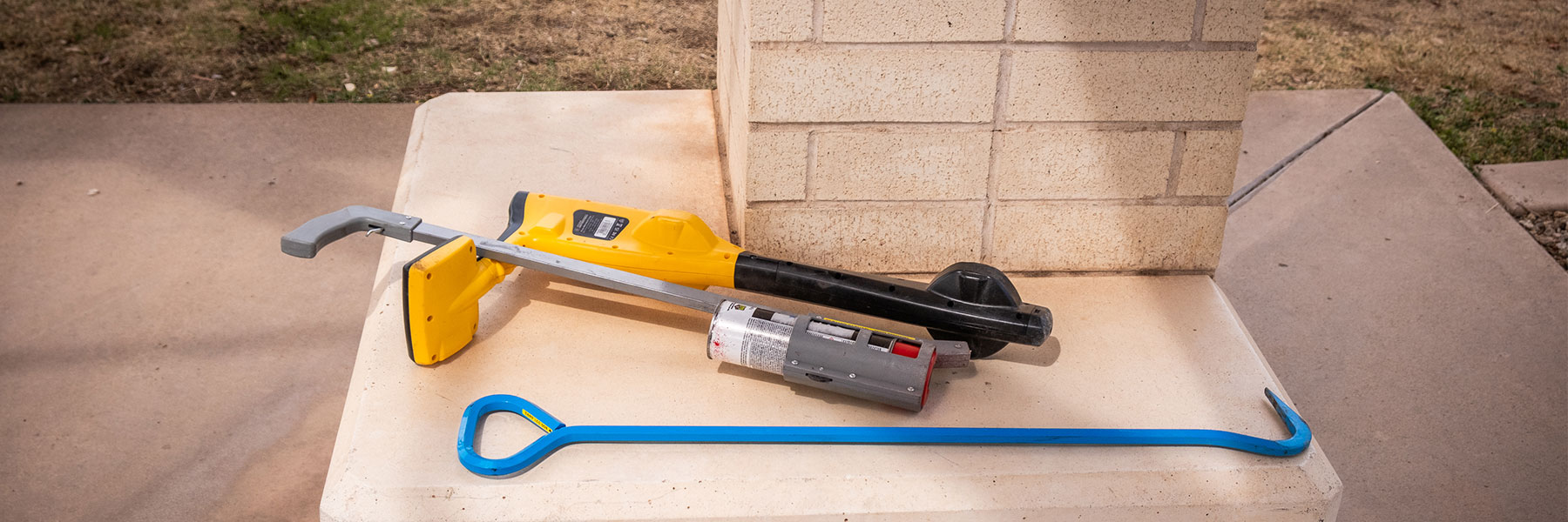
Electromagnetic (EM) utility locators are the foundation of modern utility locating. These devices help technicians detect conductive underground utilities by tracing electromagnetic signals through buried infrastructure.
This equipment typically includes two major components:
- The Transmitter: Applies an electrical signal onto the utility line.
- The Receiver: Detects that signal from above ground, allowing the technician to trace the utility path accurately.
Together, these tools help locate critical utilities such as power lines, communication cables, metallic water lines, and gas tracer wires. Because electromagnetic locating provides fast and reliable results, it remains one of the most widely used utility locating methods in the industry.
How Electromagnetic Locating Works
The locating process begins when a technician applies a signal directly or indirectly to a buried utility.
The signal then travels through the underground line. Using the receiver, the locator follows the signal path from the surface while identifying:
- Horizontal direction
- Utility depth
- Signal strength
- Potential utility interference
Experienced technicians adjust frequencies and settings based on site conditions to improve locating accuracy. This process requires both technical knowledge and field experience, especially in congested underground environments.
Ground Penetrating Radar (GPR)
Not every underground utility contains metal. Modern infrastructure often includes non-metallic materials such as PVC, concrete, and plastic piping systems. Traditional electromagnetic locators cannot detect these utilities effectively because they cannot carry an electrical signal.
That is where Ground Penetrating Radar becomes essential.
Ground Penetrating Radar, commonly called GPR, uses high-frequency radio waves to scan beneath the surface. As the radar waves travel underground, they bounce back when they encounter buried objects or changes in material density. The system then creates a visual representation of subsurface conditions.
GPR helps utility locating professionals identify:
- Non-metallic pipes and PVC utility lines
- Concrete structures and underground voids
- Unknown buried objects and abandoned infrastructure
Because GPR does not rely on conductive signals, it adds a critical layer of verification during the locating process.
Choosing the Right Tool: EM Locating vS GPR
Although both technologies support utility locating, they serve entirely different purposes. To get the most accurate results, professional utility locating companies almost always combine both methods.
| Technology | What It Detects Best | The Business Benefit |
|---|---|---|
|
Electromagnetic (EM) Locating |
Metallic utilities, tracer wires, and active conductive systems (power, comms). |
High precision for tracing specific, continuous lines over long distances. |
|
Ground Penetrating Radar (GPR) |
Non-metallic utilities (PVC, concrete), unknown objects, and structural voids. |
Acts as a safety net, revealing unmapped hazards that carry no electrical signal. |
Advanced Utility Locating Receivers
Receivers play a critical role in utility locating operations. These handheld devices help technicians interpret underground signals while tracing buried infrastructure from the surface.
Modern locating receivers include advanced features designed to protect your bottom line:
- Digital signal processing: Slices through background noise in crowded environments.
- Depth estimation: Gives excavation crews a clearer picture of the digging safety zone.
- GPS integration: Logs data automatically for digital mapping.
- Interference filtering: Helps eliminate false readings near structural metal or overhead lines.
High-quality receivers improve locating precision, especially in areas with multiple overlapping utilities.
Multi-Frequency Locating Equipment
Different underground environments require different locating frequencies. Across the US, there are different types of soil that impact the efficiency of GPR.
Low frequencies often travel farther and work well for long-distance utility tracing. Higher frequencies, however, may improve detection on shorter or poorly grounded utilities.
Advanced utility locating equipment allows technicians to switch between frequencies depending on soil conditions, utility type, and signal interference. This flexibility allows crews to slice through signal interference in crowded city streets, ensuring they don’t misidentify a high-voltage line or cross a critical feed.
GPS Mapping Technology in Utility Locating
Modern utility locating goes beyond temporary paint markings. Many utility locating companies now use GPS mapping technology to create digital utility records for construction teams, engineers, and municipalities.
GPS-integrated locating systems help document utility paths, precise locate points, depth information, and overall site conditions.
Digital mapping improves project coordination while providing long-term infrastructure documentation. In large-scale construction projects, GPS utility mapping significantly improves planning efficiency and future maintenance operations long after the spray paint has washed away.
Signal Clamps and Induction Equipment
Not every underground utility can be accessed directly. In some cases, technicians must use specialized signal clamps or induction equipment to apply locating signals safely.
- Signal Clamps: Apply signals onto accessible utilities (like valves or meters) without direct electrical contact.
- Induction Equipment: Allows technicians to introduce signals indirectly from above ground when a utility is entirely inaccessible.
These tools become especially useful when locating energized utilities, restricted-access systems, or difficult utility connections. Proper use of induction equipment requires extensive field experience because indirect signals can easily bleed off into nearby utilities if not managed carefully.
Standardized Utility Marking Equipment
Once utilities are located, technicians mark their positions on the surface using industry-standard utility marking colors. This universal color code ensures that anyone on the job site can understand underground conditions at a glance:
 Red: Electric power lines, cables, conduit, and lighting cables
 Yellow: Gas, oil, steam, petroleum, or gaseous materials
 Blue: Potable water
 Orange: Communication, alarm or signal lines, cables, or conduit
 Green: Sewers and drain lines
Accurate, highly visible utility markings help excavation crews work confidently and drastically reduce the likelihood of accidental utility strikes. We’ve dedicated an article explaining the different types of colors and their meaning.
Case Study: Saving a $50,000 Project Timeline
A contractor preparing to expand a commercial parking lot requested a private utility locate before breaking ground. Initial site drawings showed only basic electrical and water infrastructure crossing the project area.
However, during the utility locating process, the technicians deployed both electromagnetic locating equipment and Ground Penetrating Radar to cross-verify the site. The locating team quickly identified an undocumented, highly sensitive fiber optic communication line running directly through the planned excavation zone.
The Result: Because the advanced equipment detected the buried line before digging began, the contractor immediately adjusted their excavation plan. That single location prevented a massive communication outage, thousands of dollars in emergency repair fines, and a complete project shutdown.
Why Technology Alone Is Not Enough
Even the most advanced utility locating equipment requires skilled technicians to operate correctly. Utility locating involves much more than simply waving a scanner over the ground.
Experienced utility locating professionals understand how to interpret signal distortion, underground interference, congested utility corridors, variable soil conditions, and inconsistent readings. They also know exactly when to combine technologies to verify results and eliminate uncertainty.
That combination of advanced equipment and field expertise is what separates professional utility locating from guesswork.
The Future of Utility Locating Technology
The utility locating industry continues to evolve rapidly. New technologies are improving underground detection accuracy while helping contractors manage increasingly complex infrastructure systems.
Emerging innovations include AI-assisted utility interpretation, 3D underground mapping, cloud-based utility records, and integrated GIS systems. As underground infrastructure continues to expand, advanced utility locating equipment will become even more important for safe, profitable excavation practices.

Ready to Dig with Confidence?
Successful excavation begins with accurate underground utility detection. Professional utility locating equipment helps crews identify buried infrastructure safely, efficiently, and accurately before digging starts to save time, money, and lives.
Don’t leave your project’s safety to guesswork or outdated site blueprints. Whether you are breaking ground on a major commercial development or a simple utility extension, our team combines cutting-edge technology with field-tested expertise to protect your timeline and your budget.
Contact Us Today to Schedule a Private Utility Locate or Get a Free Quote!