Ground Penetrating Radar (GPR)
What is Ground Penetrating Radar (GPR)?
GPR Signal Transmission and Data Interpretation
How does Ground Penetrating Radar work?
How GPR Reveals What’s Below the Surface
GPR uses high-frequency radio waves to detect objects, material changes, and voids beneath the surface. The signals reflect off subsurface structures, allowing us to create detailed maps of buried utilities and other hidden features.
GPR is especially effective for locating non-metallic materials, abandoned pipelines, underground storage tanks, and structural voids, areas where traditional metal detectors or records may provide incomplete information.
Benefits of GPR for Your Project
Ground Penetrating Radar (GPR) provides clear, non-destructive insight into subsurface conditions, helping project teams identify underground utilities, voids, and structural features before excavation begins. Using both 2D and 3D survey methods, GPR improves planning, reduces risk, and supports safer, more efficient project execution.
Key benefits of GPR include:
- Improved visibility of underground conditions
- Reduced risk of utility strikes and site damage
- Better decision-making during design and pre-construction
- Minimal disruption to active or sensitive sites
Benefits of 2D Ground Penetrating Radar
It’s ideal for targeted or smaller investigations, providing a linear view of subsurface features for quick and cost-effective verification in specific areas.
Benefits 3D Ground Penetrating Radar
It delivers a comprehensive three-dimensional view of underground conditions by collecting data along multiple parallel paths. This approach improves accuracy, reduces the chance of missed utilities, and minimizes survey time on complex projects.
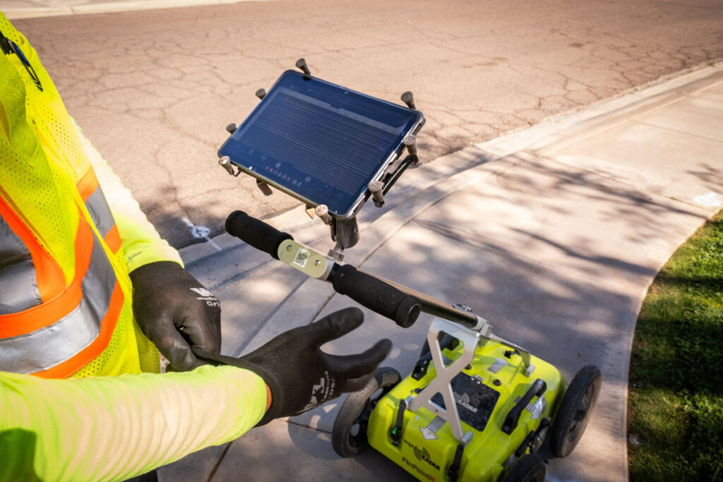
Raptor GPR Radar
High-Resolution Subsurface Imaging with the Raptor 3D System
At Safe Site, we use an innovative technique called the Raptor 3D Ground Penetrating Radar (GPR).
This system delivers fast, accurate, and high-resolution subsurface mapping.
What is Raptor GPR?
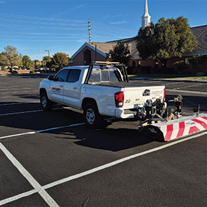
Raptor GPR is a multichannel, high-speed 3D GPR array designed to collect dense, three-dimensional data beneath the surface at speeds up to 80 mph, with data points recorded every 2 inches.
In addition, it outperforms traditional single-line or low-speed GPR systems. In fact, the high channel count and real-time sampling enable a full 3D view of underground conditions from a single pass.
Traditional GPR vs Raptor GPR
Traditional single-line GPR often requires multiple passes and can produce gaps or errors, but Raptor’s 3D-array delivers clear, intuitive underground images for faster, more reliable interpretation.
Its flexible design adapts to any project, from compact push-cart setups in tight spaces to vehicle-mounted surveys for large corridors, scaling up to 18 channels or more to handle diverse site conditions.
Benefits of Raptor GPR Radar
Raptor GPR takes 3D mapping to the next level. It collects high-density data at driving speeds, allowing large areas such as roadways, utility corridors, and construction sites to be scanned quickly. The system produces clear, reliable 3D images, reducing the chance of utility strikes and helping teams plan with confidence. Its flexible design adapts to tight urban spaces or long linear surveys, making it safe, efficient, and cost-effective for large-scale projects.

Why Choose Safe Site
Your Ground Penetrating Radar Services
When it comes to locating underground utilities, voids, and subsurface anomalies, precision, safety, and experience matter. Our GPR services deliver accurate results, actionable insights, and peace of mind, helping you plan and execute projects efficiently and safely.
Precise Subsurface Mapping
We locate underground utilities, voids, and rebar with unmatched accuracy. By identifying potential conflicts before excavation, we help prevent costly delays, damage, or project interruptions.
Detailed Reports
Our reports translate complex GPR data into clear visuals and concise summaries. You’ll receive the information you need for planning, regulatory compliance, and future maintenance.
Safe & Non-Destructive Technology
GPR scans are non-invasive, reducing the need for digging and protecting both your team and existing infrastructure. Our methods uncover subsurface conditions without disrupting your site.
Experienced Team & Fast Results
Our trained professionals deliver rapid, reliable results with expert interpretation. We ensure your project stays on schedule, on budget, and fully informed every step of the way.
What's next?
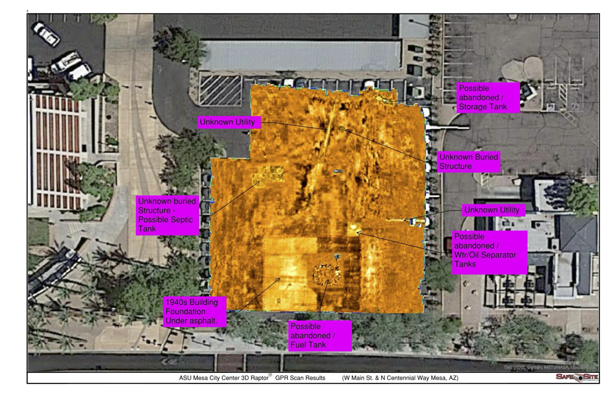
After completing a GPR survey, clients receive detailed 3D subsurface maps, precise utility location coordinates with depth information, and comprehensive survey reports that include diagrams and files compatible with CAD and GIS systems. These deliverables provide a clear, accurate record of underground conditions, helping project teams make informed decisions, plan safely, and reduce the risk of unexpected complications during excavation.
Frequently Asked Questions (FAQs)
Some frequently asked questions to help you understand our service in details.
When is GPR the right solution for my project?
GPR is ideal when existing records are incomplete or when non-metallic utilities, voids, or buried structures need to be identified before excavation or drilling.
What types of projects typically use GPR services?
GPR is commonly used on construction sites, infrastructure projects, roadway work, utility investigations, and facility assessments.
What information will I receive after the survey?
Clients receive subsurface maps, utility location and depth information, and survey reports that can be used for planning, design, or excavation.
Can GPR be performed on active or occupied sites?
Yes. GPR surveys are non-invasive and can be completed with minimal disruption to ongoing site operations.
Does GPR replace traditional utility locating methods?
GPR is often used alongside traditional locating methods to provide a more complete understanding of subsurface conditions.
Get your project started
with your free quote
Contact us to discuss how a GPR survey can support your project’s planning, safety, and risk management needs!