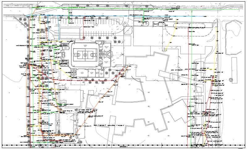
Utility Mapping
Safe Site utility mapping utilizes Trimble GPS data collectors to acquire utility location data that can be overlaid on CAD or aerial view site maps providing customers with a permanent record of site utilities.
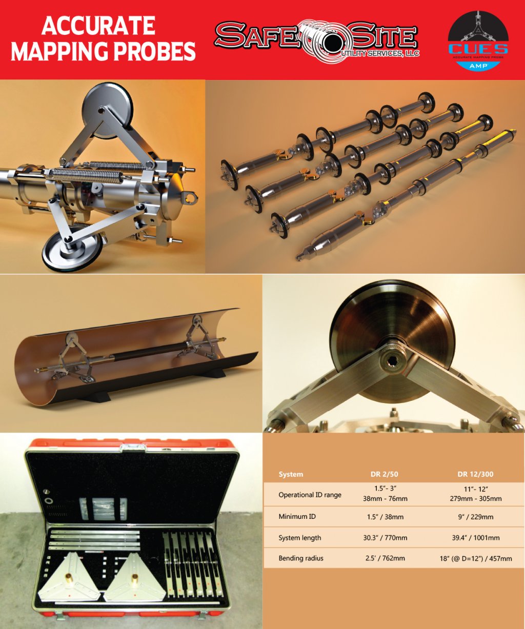
Safe Site Utility Mapping Services provides non-traditional utility locating capability through the use of its innovative AMP™ (Accurate Mapping Probe). If your company has tried conventional pipe/conduit locating techniques with limited success, or if conventional methods do not apply due to the unique conditions of your project (under water, deep installations, etc.), the CUES AMP™ might be the solution for you!
With a proven track record on virtually every continent, our AMP™ technology has been used in a variety of industries and applications.
Contact us today to discuss how your project can benefit from the CUES AMP™.
Depending on your need and preference, the CUES AMP™ is available for use both as a “self-service” (rental arrangement where we supply the tool and you supply the labor) and a “full service” product (where we provide all labor and equipment for your project).
Contact us For current pricing.
Regardless of whether you rent or buy, the CUES AMP™ includes free access to our powerful AMPVUE™ software. AMPVUE™ provides the ability to manage your AMP™ data, create detailed reports and transform AMP™ output for instant download into standard GIS and CAD formats.