In every construction or infrastructure project, understanding what lies beneath the surface plays a critical role in project success. Whether you build roadways, expand utilities, or prepare foundations, unknown subsurface conditions can quickly cause costly redesigns, safety hazards, and project delays. Because of this, Subsurface Utility Engineering (SUE) has become essential for modern infrastructure planning.
SUE reduces underground utility risks by collecting, verifying, and classifying utility data into clear quality levels. These levels (A, B, C, and D) show how accurate and reliable the information is. As a result, project teams can make better design decisions, improve budgeting accuracy, and increase construction safety.
What is Subsurface Utility Engineering (SUE)?
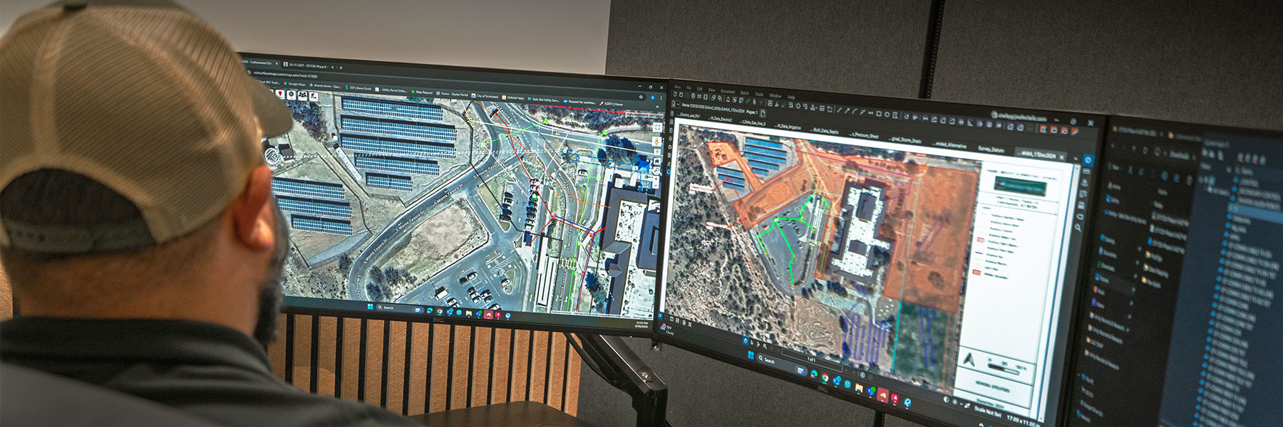
Subsurface Utility Engineering (SUE) uses a systematic process to locate, map, and document underground utilities. It combines records research, geophysical detection, surveying, and selective excavation to deliver reliable utility data for engineers and contractors.
In addition, industry standards from the American Society of Civil Engineers (ASCE), including ASCE/UESI CI 38-02 and CI 38-22, guide how professionals collect and classify utility information.
Unlike basic utility locates such as 811 calls, SUE combines records, field investigation, surveying, and utility designation to provide reliable utility information for engineering and design.
Therefore, project teams reduce uncertainty, avoid unexpected conflicts, and limit costly change orders.
SUE information is organized according to ASCE quality levels, allowing engineers and project teams to understand the confidence level associated with each utility location.
Understanding the SUE Quality Levels: A, B, C, and D
SUE classifies utility data into four quality levels based on how teams collect and verify the information. These quality levels are progressive, meaning projects may begin with QL-D records, incorporate QL-C observations, advance to QL-B geophysical investigation, and use QL-A verification at critical locations. Let’s break them down from highest accuracy to lowest.
Quality Level A (QL-A):
Locating with Precision
What It Is:
Quality Level A provides the highest accuracy in SUE. Crews physically expose utilities using non-destructive methods such as hydro excavation or air excavation. They commonly refer to this process as “daylighting.”
After exposure, survey teams measure utilities precisely and record their horizontal and vertical positions with the highest level of accuracy. They also document characteristics such as size, material, and other observable attributes.
Key Characteristics:
- Provides accurate 3D utility locations
- Verifies depth and alignment in the field
- Records detailed utility attributes
- Integrates directly into final design models
When to Use It:
- During final design stages
- In high-risk or congested utility areas
- At critical crossings or tie-in points
Benefits:
- Prevents unexpected utility conflicts
- Reduces costly redesigns and delays
- Gives engineers maximum confidence


Quality Level B (QL-B):
Designating Horizontal Locations
What It Is:
Quality Level B uses surface geophysical methods to detect underground utilities.
Crews rely on tools such as ground-penetrating radar (GPR), electromagnetic locating, and similar technologies to determine the approximate horizontal location of underground utilities without excavation.
Key Characteristics:
- Detects utilities using non-invasive methods
- Identifies horizontal utility positions
- Maps findings to survey control systems
When to Use It:
- During preliminary design phases
- When teams need early conflict detection
- When engineers refine layout options
Benefits:
- Reveals unknown or undocumented utilities
- Reduces uncertainty compared to record-only data
- Improves early design accuracy
Limitations:
- Does not provide verified depth information.
- Some complex conditions (wet soils, deep lines) may reduce accuracy.
Quality Level C (QL-C):
Correlating Visible Field Feature
What It Is:
Quality Level C improves utility data by combining existing records with visible field features. Survey teams locate surface indicators such as manholes, valve boxes, poles, and meters, then match them with utility records.
Key Characteristics:
- Uses visible surface utility features
- Confirms and refines existing records
- Does not verify underground alignment between points
When to Use It:
- During early design phases
- For moderate-risk projects
- When teams need basic field context
Limitations:
- Cannot detect buried utilities without surface markers
- May still include alignment or depth errors


Quality Level D (QL-D):
Documentary Research
What It Is:
Quality Level D relies entirely on existing records. Teams review utility maps, as-built drawings, historical documents, and stakeholder information.
Key Characteristics:
- Based solely on available documentation and records.
- Provides a general idea of potential utilities in a project area.
- No field verification or surveying is performed.
When to Use It:
- Early project planning (feasibility studies, route selection).
- Projects with minimal excavation risk.
- Situations where preliminary insight is sufficient.
Limitations:
- Utility records may be outdated, incomplete, or inaccurate.
- Often misses unrecorded utilities.
QL-D information alone is generally insufficient for final design or excavation planning because records may not represent current field conditions.
Choosing the Right Level for Your Project
Project teams select SUE levels based on risk, budget, and project stage. However, each level plays an important role in the design process.
- Teams use QL-D and QL-C during early planning to gather baseline information.
- They move to QL-B during preliminary design to improve accuracy and reduce uncertainty.
They use QL-A when a project requires the highest level of certainty, such as during final design, at critical utility crossings, or before high-risk excavation activities.
In addition, investing in higher-quality SUE data often reduces total project costs by preventing redesigns, utility conflicts, and delays.
Why SUE Data Matters to Engineers and Contractors
Inaccurate underground utility information remains one of the leading causes of construction delays, safety incidents, and change orders. Because of this, Subsurface Utility Engineering has become a critical part of modern infrastructure delivery.
SUE helps project teams improve design accuracy and coordination while also reducing utility strike risks during excavation. In addition, it strengthens communication between stakeholders and supports permitting and regulatory compliance.
Ultimately, when teams apply the correct SUE level, engineers design with greater confidence, avoid unexpected issues, and keep projects on schedule and within budget.
F.A.Q.
How do I know which SUE level my project requires?
The right SUE level depends on your project’s complexity, risk, budget, and the potential impact of unknown utilities. For early planning, a lower SUE level may be sufficient. However, as a project moves into design and construction, higher accuracy levels such as SUE Quality Level A become critical to verify the exact horizontal and vertical location of underground utilities.
Is SUE Level A always necessary before excavation?
Not every project requires SUE Level A, but it is the highest standard of utility verification and is often recommended in high-risk areas or where utility conflicts could cause delays, redesigns, or costly damages. By exposing utilities through non-destructive methods like vacuum excavation, teams gain the confidence needed to build safely.
Can SUE services reduce construction delays and change orders?
Yes. Accurate utility data helps engineers and contractors identify conflicts before construction begins. By understanding what is underground during the design phase, project teams can avoid unexpected utility strikes, redesign costs, schedule disruptions, and expensive change orders.
What is the difference between utility locating and SUE?
Utility locating identifies the approximate location of underground infrastructure, while Subsurface Utility Engineering combines utility investigation, surveying, mapping, and quality classification to provide a more complete and reliable understanding of existing underground conditions. SUE delivers the level of accuracy needed for engineering and construction decisions.
When should SUE be performed during a project?
SUE provides the greatest value when completed early during planning and design. The earlier utility conflicts are identified, the more opportunities project teams have to adjust designs, reduce risk, and control construction costs.
Why choose Safe Site for SUE services?
Safe Site combines advanced technology, experienced utility professionals, and a nationwide service network to deliver accurate subsurface data for projects of every size. From utility locating and mapping to SUE Quality Level A investigations, our team helps contractors, engineers, and municipalities make informed decisions before breaking ground.

How Safe Site Can Help
At Safe Site, LLC, we specialize in comprehensive SUE services across all quality levels (from records research and Level D data collection to Level A) daylighting using advanced vacuum excavation and precision survey methods. Our team works closely with engineers, designers, and contractors to ensure utility information is accurate, complete, and tailored to your project needs.
Whether you’re preparing for design, construction, or risk mitigation, understanding the SUE quality levels will help you make smarter decisions and avoid costly delays.
Contact us today to discuss the right SUE strategy for your next project.