
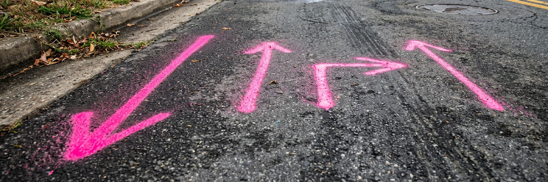
Pink utility markings identify temporary survey information on construction sites. Surveyors use pink spray paint, flags, and stakes to mark reference points, benchmarks, and other measurements that help construction teams maintain accurate site layouts.
Unlike red, yellow, or orange utility markings, pink does not identify an underground utility. Instead, it communicates survey-related information that supports construction planning, grading, excavation, and infrastructure installation.
The American Public Works Association (APWA) includes fluorescent pink in its Uniform Color Code for temporary construction project site survey markings and for making survey monuments easier to see.
For contractors, engineers, and excavation crews, understanding these markings is essential. Survey information helps teams follow project plans, maintain accurate measurements, and avoid disturbing important reference points during construction.
What Does Pink Spray Paint Mean?
Pink spray paint, flags, and stakes identify temporary survey markings. Surveyors use these markings to communicate important information about a construction site’s layout, measurements, and reference points.
Depending on the project, pink markings may identify:
Survey control points: Established reference points that surveyors use to maintain consistent measurements and positioning across a project.
Benchmarks: Known elevation reference points that help crews establish and verify vertical measurements.
Layout reference points: Locations that help crews position structures, roads, foundations, and other project features according to engineering plans.
Survey monuments: Physical markers that identify established survey reference locations and may need temporary visibility during construction.
These markings help surveyors and construction teams work from consistent field references. However, their exact purpose depends on the project and the information provided by the surveying team.
Why Are Pink Survey Markings Important in Construction?
Pink and white are both part of the APWA Uniform Color Code. However, they serve two different purposes.
- Pink: Identifies temporary survey markings and survey reference points.
- White: Identifies the proposed excavation area or route of planned excavation.
This distinction matters because survey markings do not necessarily indicate where contractors should dig. Instead, they communicate reference information that helps establish and maintain the project’s layout.
For example, a surveyor may use pink paint to identify a control point near a proposed trench. The excavation crew may then use white paint to outline the actual area where digging will take place.
By understanding the difference, contractors can distinguish survey information from excavation limits before mobilizing equipment or disturbing the ground.
Pink vs. White Utility Markings: What's the Difference?
Accurate survey information is essential before construction and excavation begin. Even small positioning errors can affect foundation placement, underground infrastructure installation, grading, and roadway alignment.
Pink survey markings help field crews identify important reference information and maintain consistency between engineering plans and actual site conditions.
For example, consider a commercial construction project where crews need to install underground storm drainage before pouring a building foundation. Surveyors establish reference points to help the team follow the approved site layout and verify elevations.
If excavation crews disturb those reference points without documenting or replacing them, surveyors may need to return to the site and reestablish the measurements. As a result, the project could face additional fieldwork, coordination challenges, and schedule delays.
Similarly, on a roadway project, surveyors use reference points to help crews maintain the intended alignment and elevation throughout different construction phases.
In other words, pink markings communicate survey information that helps construction teams maintain accuracy from initial planning through field execution.
What Should Contractors Do When They See Pink Markings?
Contractors should treat pink survey markings as important project references, not as utility locations or decorative paint. Before disturbing marked areas, crews should understand what the markings represent and whether they need to remain in place.
Follow these practices:
What Should Contractors Do When They See Pink Markings?
Identify the purpose of the markings
Consult the project survey drawings, field notes, or surveying team to determine whether the markings identify control points, benchmarks, layout references, or other survey information.
Identify the purpose of the markings
Consult the project survey drawings, field notes, or surveying team to determine whether the markings identify control points, benchmarks, layout references, or other survey information.
Coordinate with the survey team
Before excavation or other site work affects marked locations, confirm whether crews need additional measurements or replacement references.
Keep survey information separate from utility information
Pink markings do not identify buried electrical, gas, water, sewer, or communication lines. Therefore, crews must still obtain the required utility locates and verify underground infrastructure before excavation.
Do Pink Utility Markings Identify Underground Pipes or Cables?
No. Under the APWA Uniform Color Code, pink identifies temporary survey markings, not a specific underground utility.
Other colors identify different types of underground infrastructure:
- Red: Electric power lines, cables, and conduit.
- Yellow: Gas, oil, steam, petroleum, and other gaseous materials.
- Orange: Communication, alarm, and signal lines.
- Blue: Potable water.
- Green: Sewer and drain lines.
- Purple: Reclaimed water, irrigation, and slurry lines.
- White: Proposed excavation areas
- Pink: Temporary survey markings.
Contractors should never assume that pink paint indicates a buried pipe, cable, or other utility. Likewise, the absence of utility markings does not guarantee that an area is clear for excavation.
Can Pink Survey Markings Be Removed During Construction?
Contractors should avoid removing pink survey markings while crews still rely on them as project references. These markings may help surveyors verify measurements, elevations, and construction layouts throughout different project phases.
However, construction activities such as grading, excavation, and equipment movement can damage or remove temporary markings.
If crews disturb a survey reference point, they should notify the surveying team before continuing work that depends on that information. The surveyor can then determine whether the team needs to reestablish the reference point or verify the original measurements.
Taking this step helps prevent layout errors, unnecessary rework, and delays.
Frequently Asked Questions (FAQs)
Some frequently asked questions to help you understand our service in detail.
How long do temporary survey markings remain visible?
The visibility of survey markings depends on the surface, weather, and site activity. Rain, heavy traffic, grading, and equipment movement can quickly wear away paint or displace flags. Therefore, surveyors may need to refresh markings or establish new reference points as construction progresses.
What tools do surveyors use to establish survey reference points?
Surveyors use equipment such as robotic total stations, GPS/GNSS receivers, digital levels, and laser instruments to measure positions and elevations. These tools help crews establish accurate coordinates and transfer engineering plans into the field.
What is the difference between a survey control point and a property boundary marker?
A survey control point provides a known position or elevation that surveyors use as a reference for measurements. A property boundary marker identifies a legally established property line or corner. Although both support surveying work, they serve different purposes and require different documentation.
Why do construction projects need elevation benchmarks?
Elevation benchmarks provide a fixed vertical reference that construction teams use to verify grades and elevations. For example, crews rely on these measurements when installing storm drainage, setting foundation elevations, and establishing roadway slopes. Accurate benchmarks help prevent drainage problems and construction rework.
What happens if construction work changes an established survey control point?
When construction disturbs an established control point, surveyors may need to verify its original position or establish a replacement using other documented control points. Depending on the project’s survey requirements, crews may also need updated measurements before continuing work that relies on that reference.

Need Help Beyond Pink Survey Markings?
Pink markings identify survey reference points, not underground utilities. Before excavation, contractors also need to understand what lies beneath the surface.
Safe Site provides utility locating, SUE, GPR, hydrovac excavation, and utility mapping to help identify and investigate underground infrastructure before digging.
Planning an excavation project? Contact us today to discuss your needs!