Before excavation starts, project teams need to know what is underground. However, finding a utility and documenting its location are not always the same thing.
Utility locating helps identify where underground utilities are located in the field. Utility mapping takes that information a step further by documenting utility locations in a format that project teams can use for planning, design, coordination, and future work.
So, when is utility locating enough? And when does a project need utility mapping?
Understanding the difference can help contractors, engineers, and project managers choose the right level of underground utility investigation.
What Is Utility Locating?
Finding Underground Utilities Before Construction
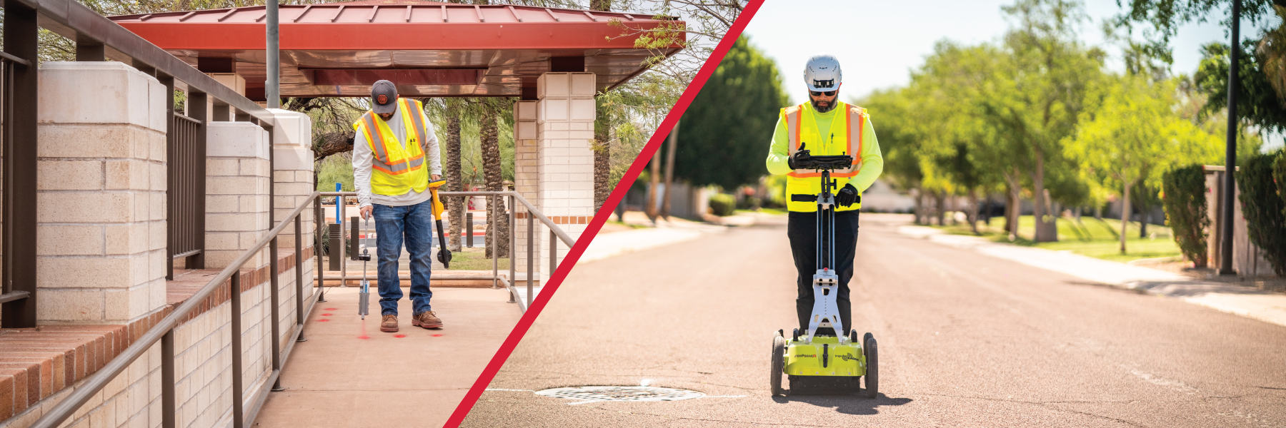
Utility locating identifies underground utilities and marks their approximate horizontal location on the ground surface.
A professional utility locating crew may use electromagnetic locating equipment, Ground Penetrating Radar (GPR), records, and other investigation methods to identify buried infrastructure.
Depending on the project, utilities may include:
- Electrical lines
- Gas lines
- Water lines
- Sewer lines
- Storm drains
- Telecommunications
- Private utilities
- Other underground structures
Utility locating is especially important before excavation, trenching, drilling, or other work that could disturb the subsurface.
The main goal is simple: identify underground utilities before construction activities reach them.
However, locating marks on the ground may not provide everything a larger project team needs.
What Is Utility Mapping?
Turning Utility Locations Into Usable Project Data
Utility mapping documents underground utility information in a digital or graphical format.
Instead of only marking utilities in the field, a utility mapping project can create a permanent record of their locations. Safe Site provides utility mapping deliverables in formats such as CAD, KML, vector, and PDF, depending on project requirements.
This information can help teams understand how underground utilities relate to:
- Property boundaries
- Roads and structures
- Proposed construction
- Other utilities
- Excavation areas
- Design plans
- Existing infrastructure
For engineers and designers, this information can become part of the larger project planning process.
In other words, utility locating helps you find the utilities. Utility mapping helps you document and use that information.
Utility Locating vs. Utility Mapping
The difference becomes easier to understand when you look at the purpose of each service.
| Utility Locating | Utility Mapping |
|---|---|
|
Identifies underground utilities |
Documents underground utility locations |
|
Primarily supports field activities |
Supports planning, design, and documentation |
|
Utilities can be marked on the ground |
Data can be delivered in digital formats |
|
Useful before excavation |
Useful throughout the project lifecycle |
|
Focuses on field identification |
Creates a record of subsurface infrastructure |
The two services can also work together.
A project may start with utility locating to identify underground infrastructure. The resulting information can then become part of a utility map that the broader project team can reference.
When Is Utility Locating Enough?
Utility locating may be appropriate when the immediate goal is to identify underground utilities before physical work begins.
For example, a contractor may need to excavate a narrow trench for a new connection. The crew needs to know what utilities cross the excavation area before digging.
In this situation, field markings can provide the information needed to plan the work.
Utility locating can be particularly useful for:
- Pre-excavation planning
- Trenching
- Drilling
- Construction activities
- Utility maintenance
- Smaller excavation areas
- Field verification
However, larger projects often require more than markings on the ground.
When Should You Consider Utility Mapping?
Utility mapping becomes more valuable when underground information needs to move beyond the jobsite.
Consider a project involving a new commercial development. Multiple contractors, engineers, designers, and project managers may need to understand the existing underground infrastructure.
Field markings can help the excavation crew. But they do not necessarily give the entire project team a permanent digital record to reference during design and coordination. That is where utility mapping can provide additional value.
Utility mapping may be appropriate when a project involves:
Design and Engineering
Engineers need reliable information about existing utilities when developing plans. Documented utility data can help the design team account for existing infrastructure before construction begins.
Large or Complex Sites
Large commercial, industrial, transportation, and municipal projects can contain extensive underground infrastructure. A utility map can organize that information so different members of the project team can reference it.
Utility Coordination
When multiple utilities occupy the same area, understanding their relationship becomes increasingly important. Mapping can help project teams visualize underground infrastructure and identify potential conflicts that require further investigation.
Future Construction
A utility map can also provide a record for future projects, maintenance, renovations, or infrastructure upgrades. Instead of relying only on temporary field markings, the project team has documented information that can remain part of the project record.
A Real-World Example
Why Locating Alone May Not Be Enough
Imagine a contractor preparing to build a new commercial facility on a developed site.
The project includes a new building, parking area, underground electrical service, storm drainage, and water connections.
Before excavation, a utility locating crew identifies several existing utilities throughout the site. The utilities are marked in the field, giving the excavation crew important information before work begins.
But the project does not stop there.
The engineer still needs to coordinate the proposed utilities with the existing infrastructure. The project manager needs to communicate the underground conditions to multiple contractors. Future crews may also need to understand what was installed and where existing utilities were identified.
In this case, field markings alone may not provide the complete project record.
Utility mapping can turn the collected underground information into usable documentation for the project team.
The key difference is not simply how utilities are found. It is how the information is used after they are found.
How Do You Know Which Service Your Project Needs?
Ask what your team needs to do with the information. If the primary goal is to identify underground utilities before excavation, utility locating may meet the immediate need.
If the project requires documented underground information for design, coordination, or future reference, utility mapping may be the better fit.
And if the site has complex or incomplete underground information, combining services may provide a more complete picture. A project team may need:
- Private utility locating
- GPR scanning
- Utility mapping
- SUE
- Hydro excavation for utility verification
- Other subsurface investigation services
The right combination depends on the project, and Safe Site can provide you with all you need.
Frequently Asked Questions (FAQs)
How accurate is utility locating?
Utility locating identifies the approximate horizontal position of underground utilities. Accuracy can vary based on the utility type, depth, site conditions, records, and locating method used.
Does utility mapping show the depth of underground utilities?
Utility mapping can include depth information when that information has been collected through appropriate investigation methods. The level of detail depends on the scope and requirements of the project.
What types of projects benefit from utility mapping?
Utility mapping can be useful for commercial developments, infrastructure projects, transportation work, municipal projects, and other sites where multiple underground utilities must be documented and coordinated. Get in touch with us to talk with our expert to learn more.
Can utility mapping identify private utilities?
Yes. Utility mapping can document private underground utilities identified during the investigation. Private utilities may not be included in standard public utility records, so additional field investigation may be necessary.
What information is included in a utility map?
Depending on the project scope, a utility map may show utility locations, types, alignments, and other relevant subsurface information. Deliverables can also be provided in formats that fit the project’s design or documentation needs.
Should I get utility locating or utility mapping first?
The answer depends on the project’s goals. If the immediate need is field identification before excavation, utility locating may be appropriate. If the project also requires documented underground data for design or coordination, utility mapping may be included as part of the investigation.
Need Help Choosing the Right Utility Service?
Every project has different subsurface requirements. Safe Site can help you determine whether your project needs utility locating, utility mapping, GPR, SUE, or a combination of services.
Our team can help you collect and document underground utility information before construction begins, giving your project team the data it needs to plan with greater confidence.
Planning an upcoming project? Talk with Safe Site about your utility locating and mapping needs. We are here to help.